As of May 2025, the total number of satellites in Earth's orbit has surged to over 11,000, reflecting a rapid expansion in global orbital infrastructure. Yet, there is a fundamental irony in this technological explosion: the vast majority of these eyes in the sky are effectively blind the moment a storm front rolls in. For decades, the reliance on optical imagery—satellites that function essentially like high-altitude digital cameras—meant that nearly 70% of the Earth was obscured by cloud cover at any given moment.
To understand the shift in global monitoring, we must look beyond the visible spectrum. Synthetic Aperture Radar (SAR) is an active sensing technology that uses the motion of a satellite-borne antenna to create high-resolution 2D images, allowing it to penetrate clouds, smoke, and total darkness. Unlike traditional optical sensors that require sunlight, SAR provides its own "illumination." This distinction is not merely academic; it is the difference between seeing a disaster unfold in real-time and waiting days for the weather to clear while lives and assets hang in the balance.
The Blind Spot in the Sky: Why Optical Satellites Struggle
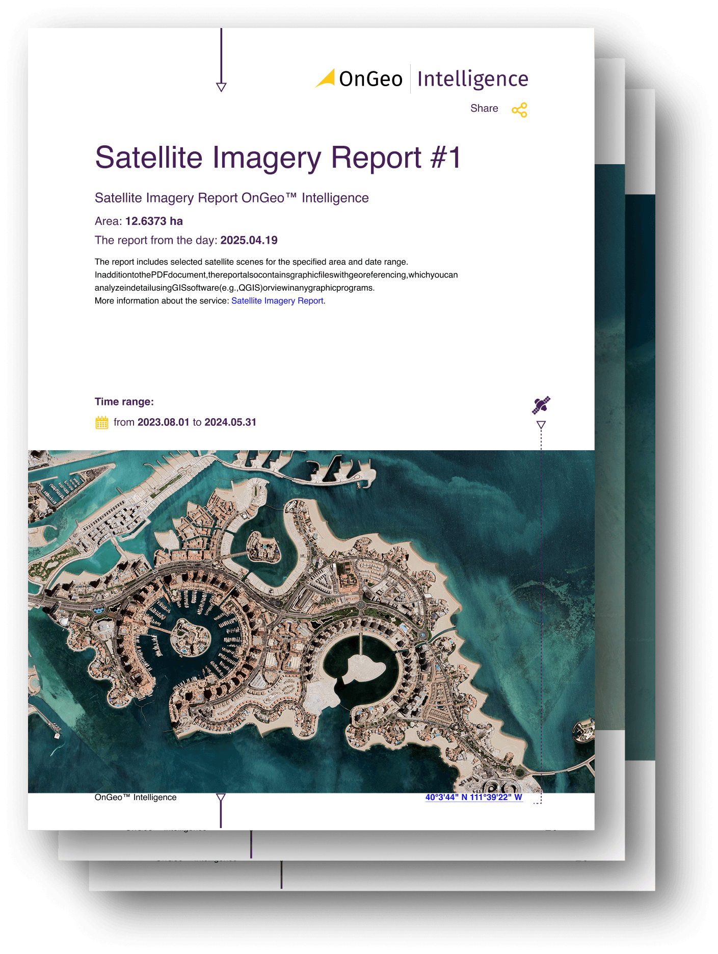
Traditional satellite imagery relies on passive sensing. These sensors capture the sun's light as it reflects off the Earth's surface. While this produces the beautiful, high-resolution "True Color" images we see on consumer mapping apps, it comes with severe operational constraints. If it is nighttime, the sensor sees nothing. If there is a thick layer of wildfire smoke or a tropical hurricane, the sensor sees nothing but the top of the haze.
Even with over 11,000 satellites currently orbiting the planet, the "revisit rate"—the frequency with which a satellite can photograph a specific spot—is often rendered meaningless by atmospheric interference. In regions like the Amazon or Southeast Asia, clouds can persist for months, creating a data vacuum. This is where SAR fundamentally changes the equation. By utilizing microwave pulses rather than visible light, SAR bypasses the atmosphere's physical barriers.
Synthetic Aperture Radar (SAR): The All-Weather 'Flash' for Earth
If optical satellites are cameras using ambient light, a SAR satellite is a camera with a high-powered, unstoppable flash. The technology works by emitting microwave pulses toward the Earth and measuring the time it takes for those signals to bounce back to the sensor.
The "Synthetic" part of the name refers to a brilliant engineering workaround. A physical radar antenna capable of producing high-resolution images would need to be kilometers long—an impossibility for a spacecraft. Instead, SAR uses the satellite’s own orbital motion to simulate a massive antenna. As the satellite moves, it takes multiple "snapshots" of the same target from different positions, which are then mathematically combined to create a single, high-resolution image.
The primary advantage of SAR over traditional optical imagery is its all-weather, 24/7 capability, which makes it indispensable for monitoring disaster zones and military movements regardless of atmospheric conditions. Because the wavelengths are much longer than those of visible light, they simply pass through cloud droplets and smoke particles without scattering.
Comparative Analysis: Optical vs. SAR Technology
| Feature | Optical Imagery | SAR (Synthetic Aperture Radar) |
|---|---|---|
| Primary Light Source | Passive (Sunlight) | Active (Microwave Pulses) |
| Day/Night Capability | Daylight Only | 24/7 Operations |
| Weather Impact | Blocked by clouds/smoke | Penetrates clouds/smoke/haze |
| Visual Intuition | Easy to interpret (looks like a photo) | Requires processing (looks like grayscale texture) |
| Data Type | Reflectance/Color | Surface Roughness/Structure/Moisture |
From Cold War Secret to Commercial Powerhouse (2018-2025)
The evolution of SAR is a classic tale of "swords to plowshares." For decades, this was a deeply classified military asset. Developed in the 1950s and 60s, SAR was used by intelligence agencies to track Soviet naval movements and missile silos through the persistent cloud cover of Northern Europe. The equipment was massive, power-hungry, and prohibitively expensive for anything other than a superpower's budget.
The democratization of this data began when the first commercial SAR satellites were launched by Capella Space in 2018. This was the pivotal moment that moved SAR from the realm of top-secret bunkers to the commercial boardroom. By miniaturizing the radar components and utilizing "SmallSat" platforms, companies could suddenly offer all-weather orbital data to insurance companies, environmental NGOs, and logistics firms.

Since that 2018 turning point, the utility of SAR has been proven in high-stakes environments. During the initial phases of the Ukraine conflict, SAR was the only reliable method for tracking troop movements during the overcast winter months. Similarly, in 2024, when devastating floods hit Southern Europe and parts of Asia, SAR provided emergency responders with precise maps of rising water levels through the very storms that caused the flooding—something optical satellites were physically incapable of doing.
The SAR Market Boom: Data and Growth Drivers
From an investment and infrastructure perspective, the numbers are as clear as the imagery SAR provides. The Synthetic Aperture Radar (SAR) market is projected to sustain a compound annual growth rate (CAGR) of approximately 7% from 2023 through 2030. This growth is driven by a shift in how industries value "continuity of data."
Historically, defense and intelligence agencies accounted for nearly 60% of SAR demand. However, as of 2025, that share is shifting. While Defense still holds a significant 45% market share, the fastest-growing sectors are now Maritime and Environmental monitoring.
- Maritime Security: SAR can detect "dark vessels"—ships that have turned off their AIS (Automatic Identification System) transponders to engage in illegal fishing or oil smuggling. Since radar reflects off metal differently than water, these ships cannot hide, even in the dead of night.
- Infrastructure Monitoring: Because SAR is sensitive to minute changes in surface height, it is used to detect "subsidence"—the gradual sinking of bridges, dams, or buildings—long before the human eye can see a crack.
- Agriculture: SAR can "see" the moisture content in soil and the structural growth of crops through the canopy, providing a level of detail that traditional NDVI (Normalized Difference Vegetation Index) sensors miss.
This data is no longer raw "noise" that requires a PhD to interpret. Modern platforms have automated the processing chain, turning complex radar backscatter into simple dashboard alerts for supply chain managers and environmental analysts.
Looking Ahead to 2026: AI, Swarms, and Real-Time Insights
As we approach 2026, the industry is moving away from "periodic monitoring" toward "persistent surveillance." The following three trends will define the next eighteen months of orbital technology:
1. AI-Enabled Change Detection
The sheer volume of SAR data is now too great for human analysts. By 2026, AI won't just process SAR images; it will autonomously detect environmental changes and infrastructure damage as they happen. If a pipeline leaks or a new road is cleared in a protected rainforest, machine learning algorithms will flag the anomaly in seconds, bypassing the need for manual review.
2. The Rise of Satellite Swarms
We are seeing a move away from single, massive satellites toward "swarms" or mega-constellations in Low Earth Orbit (LEO). Instead of waiting 24 hours for a large satellite to return to a target, a swarm of 50 smaller SAR satellites can provide "hourly revisits." This is the holy grail for logistics and military intelligence: a near-continuous video feed of the planet, unaffected by weather.
3. Direct-to-Device Integration
The ultimate frontier for 2026 is the softening of the line between orbital networks and terrestrial cellular networks. We are beginning to see the infrastructure that will allow SAR-derived alerts to be pushed directly to mobile devices in the field—giving a forest ranger in the Amazon or a relief worker in a flood zone real-time "X-ray vision" of their surroundings via satellite.

FAQ
Can SAR see through solid objects like buildings or the ground?
No. While the term "X-ray vision" is often used as a metaphor, SAR cannot see through solid structures. It reflects off the surface. However, it can "see through" light vegetation (like tree leaves) to the ground and can penetrate very dry sand or snow to a depth of a few meters, depending on the frequency used.
Why isn't SAR used for everything if it's so much better than optical?
SAR imagery is much more complex to process and interpret. To the untrained eye, a raw SAR image looks like "salt and pepper" noise. Additionally, optical imagery provides color and high-context visual details that are essential for many mapping and urban planning tasks. The two technologies are best used in tandem.
Is SAR imagery available to the general public?
Yes. While high-resolution commercial SAR data is expensive, there are open-access sources like the European Space Agency's Sentinel-1 mission, which provides free SAR data for scientific and environmental research.
Are you ready to leverage the power of all-weather orbital data? As the global landscape becomes increasingly volatile, the ability to see through the "blind spots" of weather and darkness is no longer a luxury—it is a strategic necessity. Whether you are monitoring global assets or tracking environmental changes, the evolution of SAR ensures that the truth is never hidden by a cloud.